The Survey Drone Built for Faster Results and Total Confidence
VTOL precision. Survey-grade accuracy. Alaska-proven. Request a QuoteWatch DemoAll-In-One. Survey-Grade. Built for the Field.
![]()
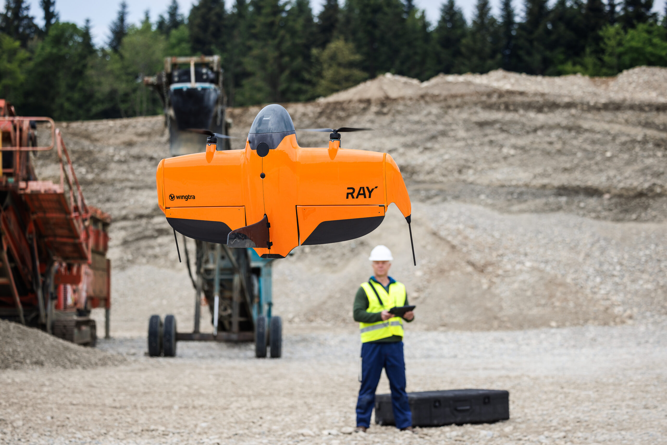
The WingtraRAY combines VTOL convenience with fixed-wing efficiency — launching vertically, flying efficiently, and delivering survey-grade results. 100 hectares in just 10 minutes. Set up in five. One platform, from flight plan to final deliverable.
AKDRONE is Alaska’s authorized Wingtra dealer. Whether you’re evaluating, ready to buy, or looking to expand your program — we’re your local team.

Built in Switzerland. Proven in Alaska.
From the Alps to the Alaska Range.
The WingtraRAY was engineered in Zurich for precision. Now it’s being put to work in the conditions that define Alaska operations — 30-knot winds, sub-zero temps, and terrain hours from the nearest road.
The WingtraRAY earns its reputation in the field — not on trade show floors. AKDRONE doesn’t just sell this platform, we fly it. Every system we deliver has been validated through real operations across Alaska before it reaches your team. Real conditions. Real data.
✓Checks All the Boxes.
Wingtra has been at the forefront of compliance and security as industry standards have evolved—achieving NDAA compliance, earning Blue UAS approval, and aligning with Green UAS requirements in its latest platforms.With FAA Category 3 certification for Operations Over People, WingtraRAY enables legal flight over roads, infrastructure, and populated areas without a waiver. When compliance matters, Wingtra is built for it.
See the WingtraRAY in Action
All-In-One or Flexible Solutions Ready to Deploy
Choose the right package for the job.
Basic
For professionals who want fast, reliable drone data capture while using their own base stations, photogrammetry software, and workflows.
1x WingtraRAY Drone
Includes PPK and operating software.
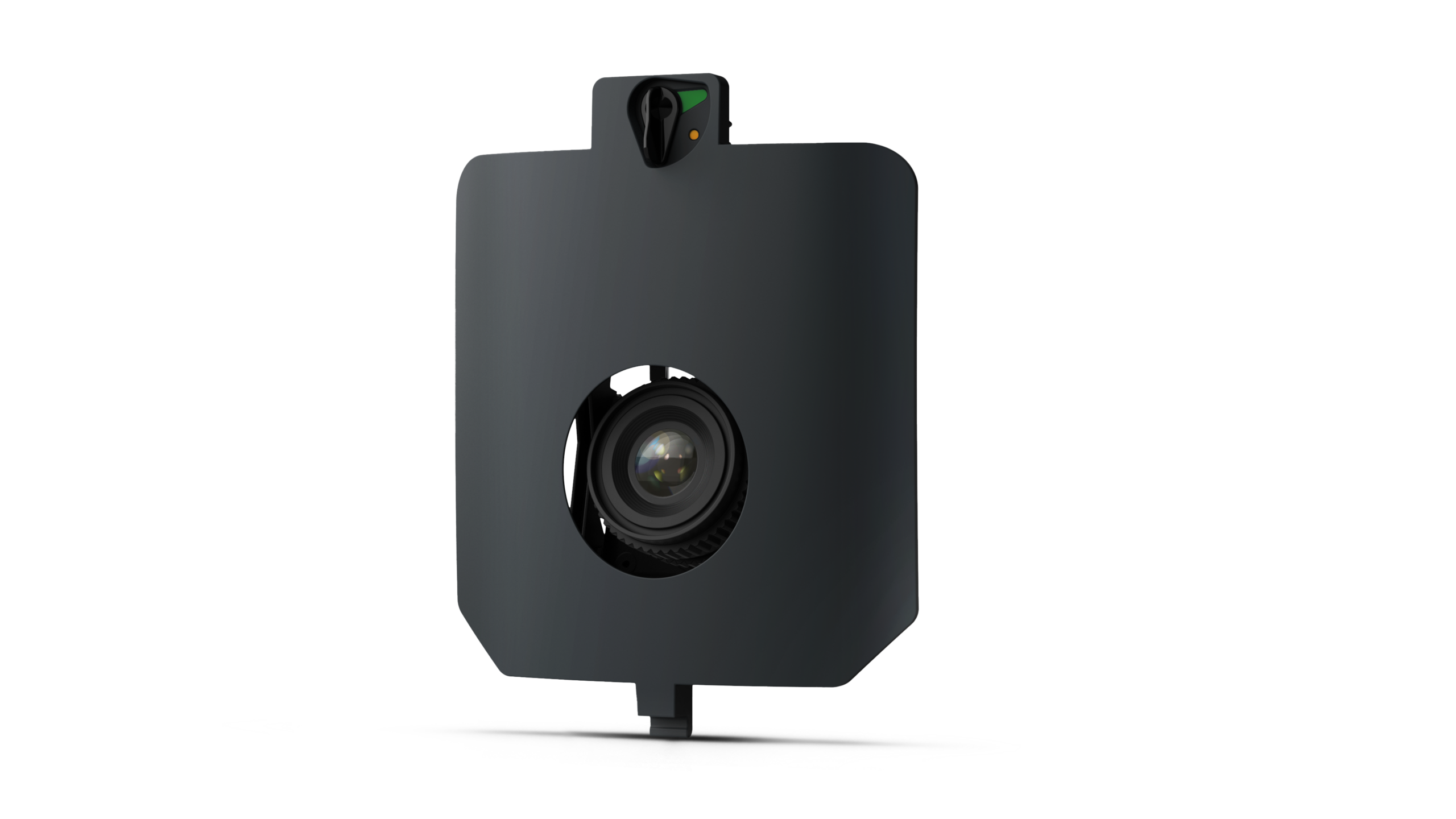
1x MAP61 RGB Sensor
Ultra-efficient sensor offering high-resolution 3D data.
1x Premium Tablet
Larger screen, all-day power and seamless connectivity in the field.
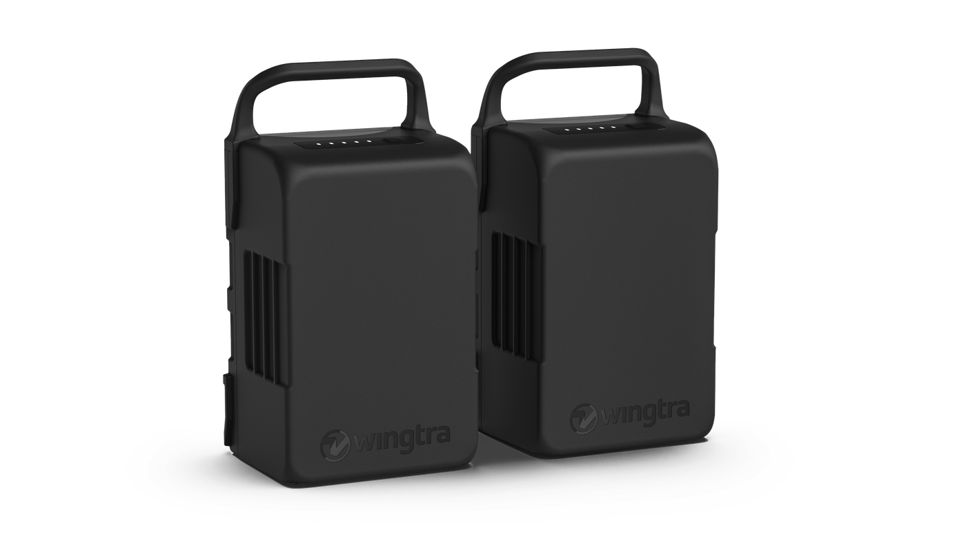
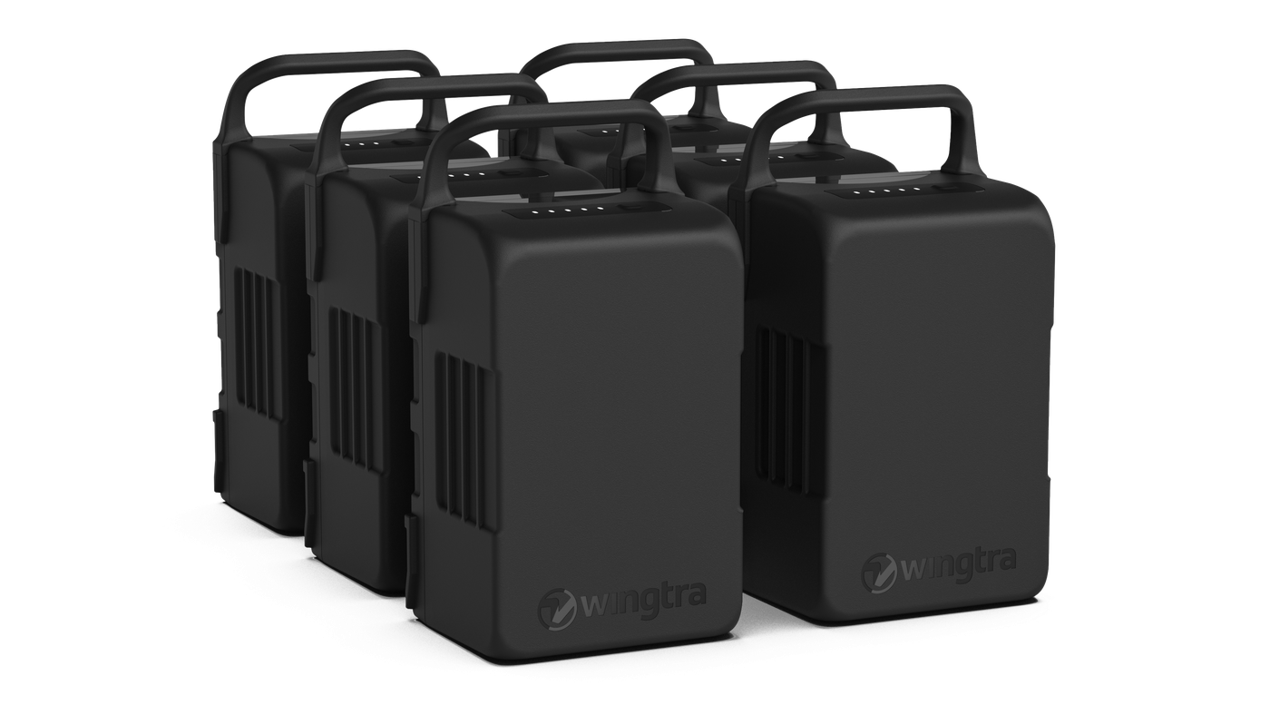
1x Extra Set of Batteries
One full extra set of batteries.
WingtraCLOUD Essential
Organize, plan, fly and capture with a single app.
- ✓Sync across devices—or run the full workflow on device without cloud upload
- ✓Plan and monitor flights in a 2D map view
- ✓Use offline maps for flight planning
- ✓Automated flights with WingtraOne (All sensors supported)
- ✓Terrain following, pause and resume, and return to home (RTH)
- ✓Geotag in global coordinate systems (WGS84, NAD83)
Advanced
For professionals who want to unlock maximum workflow efficiency with 3D flight planning, the WingtraGROUND workflow, and processing in published and local coordinate systems.
1x WingtraRAY Drone
Includes PPK and operating software.
1x MAP61 RGB Sensor
Ultra-efficient sensor offering high-resolution 3D data.
1x Premium Tablet
Larger screen, all-day power and seamless connectivity in the field.
Heavy Flyer Add-On
Extra flight gear for high-frequency or large missions.
WingtraCLOUD Pro
Everything in Essential, plus 3D terrain planning, custom layers, published and local coordinate systems, cloud links, project organization, and integrated WingtraGROUND workflow.
Ultimate
An easy-to-adopt solution for larger teams handling high project volumes with unlimited processing and high-capacity storage.
1x WingtraRAY Drone
Includes PPK and operating software.
1x MAP61 RGB Sensor
Ultra-efficient sensor offering high-resolution 3D data.

Tablet and Accessories
Includes 1x tablet, 1x set of batteries, and 1x charger.
Heavy Flyer Add-On
Extra flight gear for high-frequency or large missions.
WingtraCLOUD Unlimited
Everything in Pro, plus unlimited data processing and 4 TB storage for larger teams and higher project volumes.
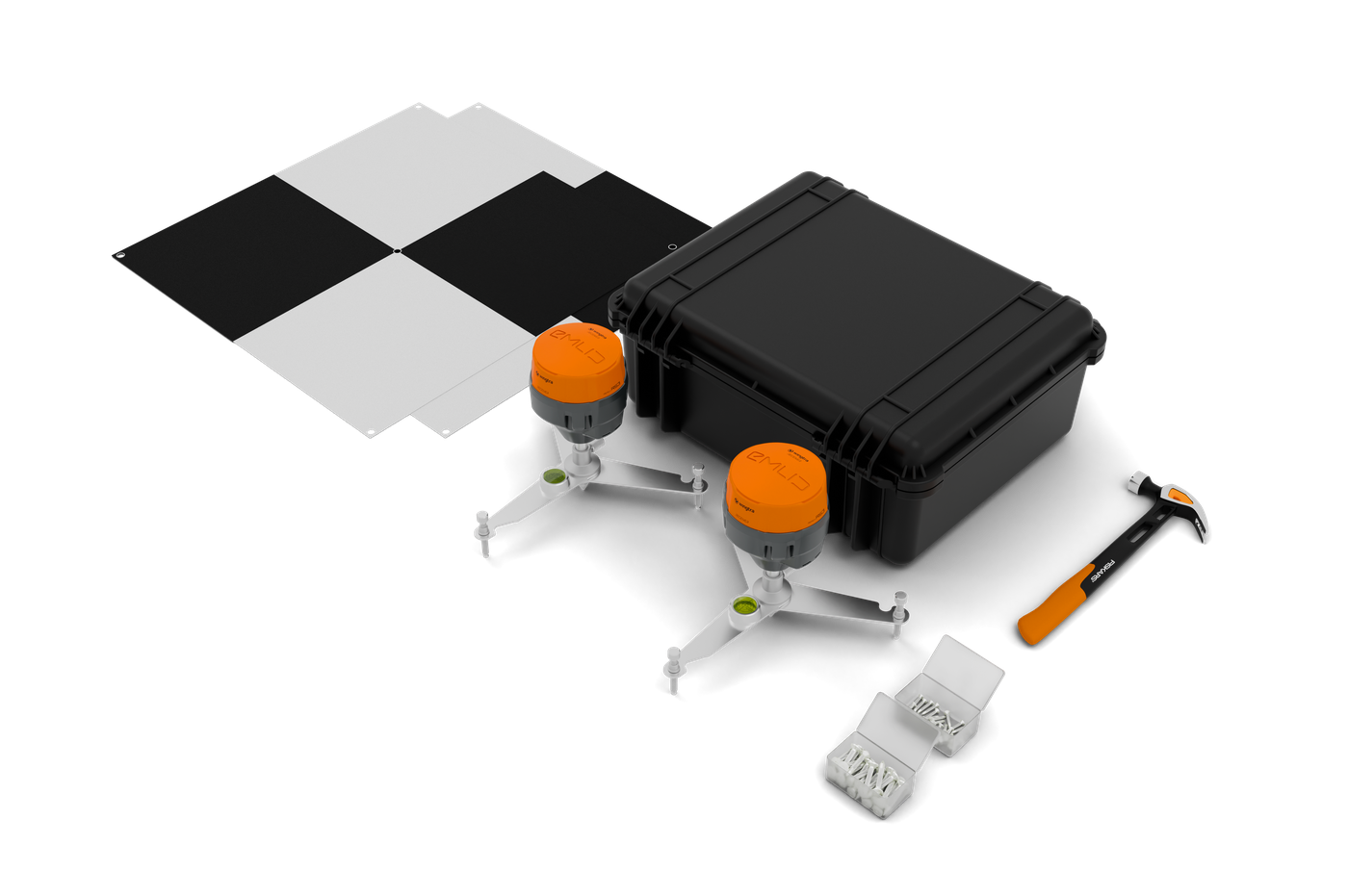
1x WingtraGROUND
Survey field kit for simplified base station and checkpoint setup.
1x Premium Tablet
Larger screen, all-day power and seamless connectivity in the field.
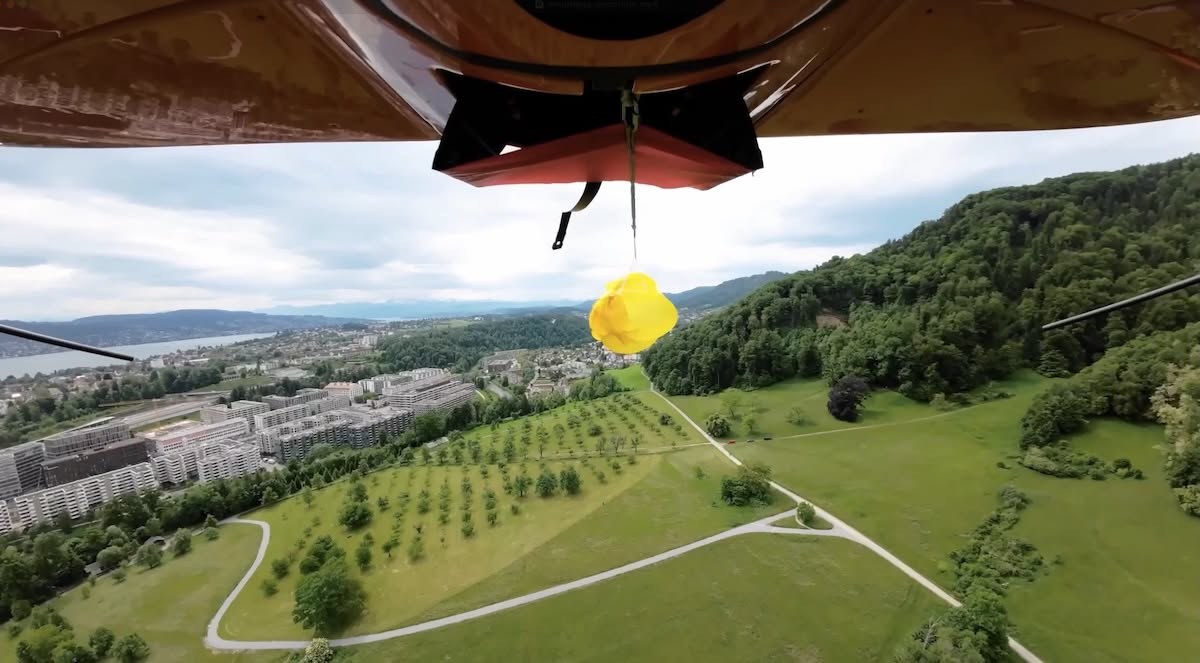
1x Parachute Add-On
Parachute for legal and secure flights in populated areas.
Accidental Damage Protection
Extends the warranty coverage to accidental damage.
1x High-Altitude Drivetrains
Drivetrains for flights above 1000 m (3280 ft) AMSL.
WingtraCARE
Protection plan covering your drone and all payloads starting from the second year.
Custom
Build the setup that fits your workflow.
Build the setup that fits your workflow
Explore the drones, sensors, software and services with our configurator.
Get Started with Your WingtraRAY
Step 1: Request a Quote
Tell us about your operation and what you need. Fill out the form below and your dedicated Account Manager will reach out to start the conversation.
Step 2: Build Your Package
Your Account Manager works with you to match the right WingtraRAY configuration to your operations — sensors, software, accessories, and training for the work you do.
Step 3: Get Flying
Unpack, power on, and launch in under five minutes. Your WingtraRAY arrives ready to work — start collecting survey-grade data on day one.
Learn More
About the WingtraRAY
Key specs:
• 500+ acres (200+ hectares) per flight
• Down to 1 cm accuracy with PPK — no ground control points needed
• Multiple interchangeable sensors: RGB (Survey61, Map61), multispectral (RedEdge-P), LiDAR, thermal
• Fully autonomous flight from takeoff to landing
• WingtraCLOUD integration for processing directly to deliverables
The WingtraRAY is used by surveyors, mining companies, DOTs, and engineers in over 100 countries.
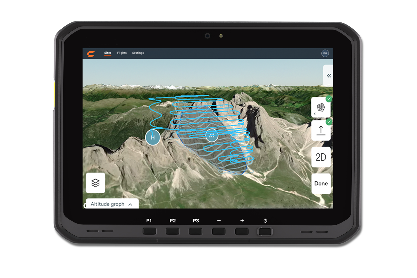
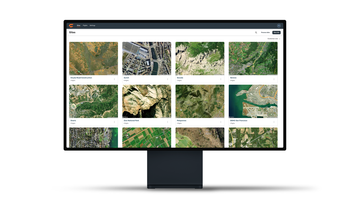
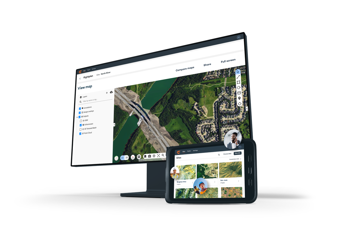
WingtraCLOUD — End-to-End Processing
One platform from flight plan to final deliverable. That’s what “all-in-one” means.
WingtraRAY Tech Specs Summary
Airframe
• Type: VTOL fixed-wing
• Wingspan: 1.48 m (4.8 ft)
• Max takeoff weight: 5.4 kg (11.9 lbs)
• Max flight time: 59 min (photogrammetry) / 45 min (LIDAR)
• Cruise speed: up to 22 m/s (49 mph)
• Max wind resistance: 14 m/s (31 mph)
• Operating temp: -20°C to 45°C (-4°F to 113°F)
Navigation & Accuracy
• GNSS: GPS, GLONASS, Galileo, BeiDou
• PPK accuracy: 3 cm (0.1 ft) RMS (x, y, z) without GCPs
• Terrain following: Yes (DSM-based)
Communication
• Radio link: 2.4 GHz, up to 10 km range
• LTE telemetry: 4G built-in (BVLOS ready)
• Dual telemetry: automatic failover
Safety
• Parachute add-on: FAA Category 3 OOP
• Backup battery: return-to-home on single battery failure
• Obstacle avoidance: 100m forward detection (beta)
• NDAA, Blue UAS, Green UAS cleared
Software
• WingtraCLOUD: plan, fly, process, share — one platform
• WingtraGROUND: GNSS base station integration
• 6,500+ coordinate systems supported
What sensors are available for the WingtraRAY?
WingtraRAY supports swappable sensors — switch payloads in seconds with no cables or tools:
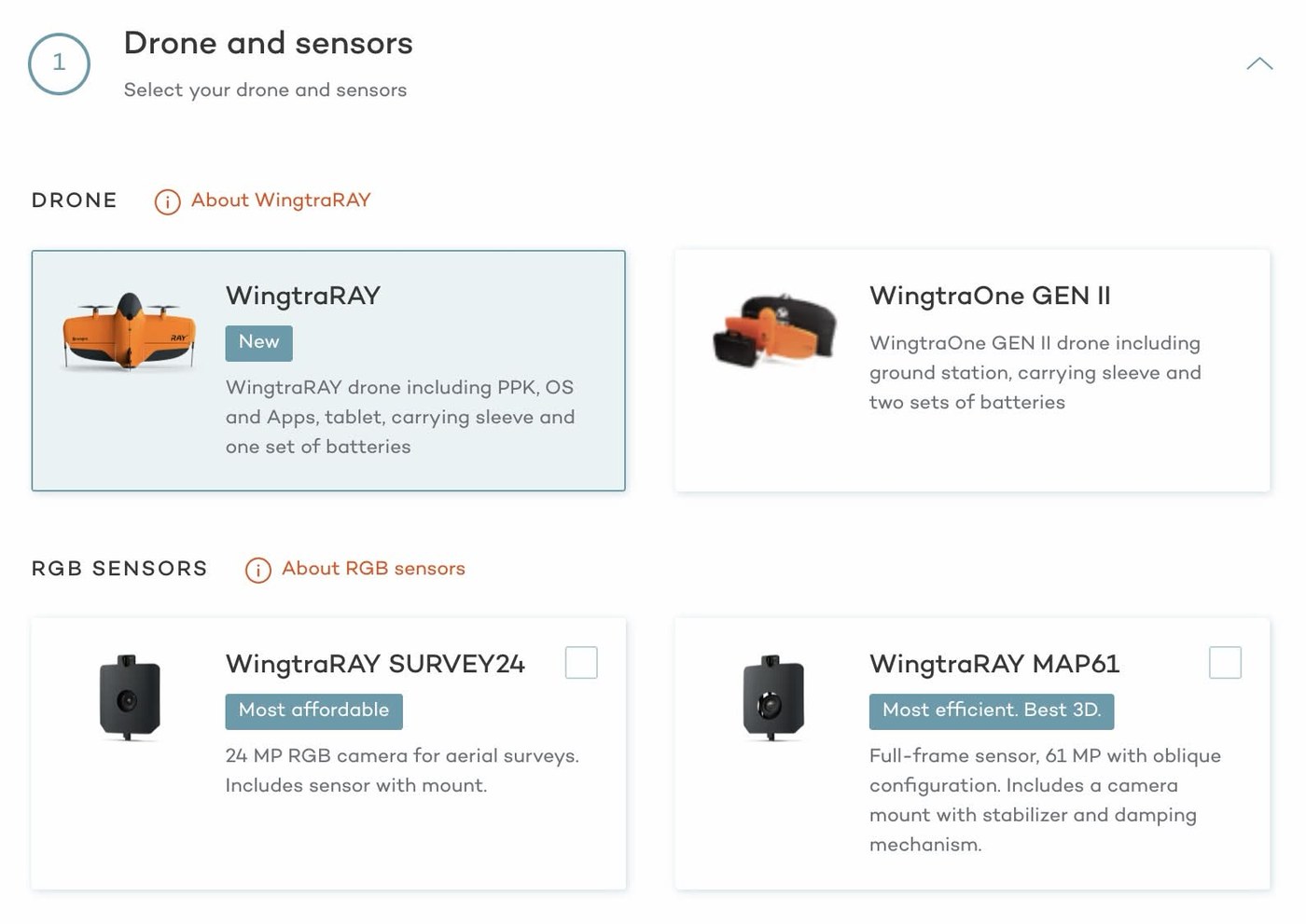
RGB Sensors
• MAP61 — 61MP full-frame, wide-angle lens (17mm), low oblique configuration. Most efficient coverage and best 3D capabilities. Up to 550 ha (1,360 ac) per flight at 120m. GSD down to 1.2 cm/px. 3 cm absolute accuracy with PPK.
• SURVEY61 — 61MP full-frame, low-distortion lens (35mm), nadir configuration. Highest quality photogrammetry with survey-grade accuracy. Up to 270 ha (670 ac) per flight at 120m. GSD down to 0.5 cm/px. 3 cm absolute accuracy with PPK.
• INSPECT — 61MP full-frame, tele lens (85mm), nadir configuration. Millimeter-resolution inspections. Up to 80 ha (200 ac) per flight at 120m. GSD down to 0.25 cm/px. 3 cm absolute accuracy with PPK.
• SURVEY24 — 24MP APS-C sensor, low-distortion lens (20mm), nadir configuration. The affordable mapping and surveying solution. Up to 330 ha (820 ac) per flight at 120m. GSD down to 1.2 cm/px.
LIDAR
• WingtraLIDAR — Easy-to-use, precise, and efficient. 110 pts/m² point density. Up to 460 ha (1,140 ac) per flight at 90m. 3 cm absolute accuracy with PPK. No calibration needed. Ideal for forestry, corridors, and terrain under vegetation canopy.
Multispectral
• RedEdge-P — MicaSense 5-band multispectral (R, G, B, RE, NIR) plus panchromatic. GSD down to 4 cm/px. Up to 180 ha per flight at 120m. 6 cm absolute accuracy with PPK. Agriculture, environmental monitoring, forestry, water management.
Can one person operate the WingtraRAY?
Yes. WingtraRAY is built for one-person field operations. Unpack, power on, follow the interactive checklist, and launch — no calibration needed, not even for LIDAR. While one person collects data in the field, the rest of the team stays focused on analysis or client delivery.
What does NDAA, Blue UAS, and Green UAS mean?
These are US cybersecurity and supply chain certifications:
• NDAA Compliant — No components from prohibited foreign manufacturers. Required for government contracts.
• Blue UAS Cleared — Approved by the Defense Innovation Unit for Department of Defense use.
• Green UAS Cleared — Approved by the Department of Interior for government operations.
WingtraRAY meets all three standards, making it eligible for federal, state, and tribal government projects — a critical advantage for Alaska operations.
Can the WingtraRAY fly over people and roads?
Yes, with the parachute add-on. WingtraRAY has FAA Category 3 OOP (Operations Over People) certification. This means you can legally survey over roads, infrastructure, and populated areas without applying for a waiver — covering 9 out of 10 US commercial drone projects.
What is PPK and why does it matter?
PPK (Post-Processed Kinematic) is a GNSS correction method that achieves survey-grade accuracy (~3 cm / 0.1 ft) without placing GCPs (Ground Control Points) on site. This eliminates hours of setup time per project and reduces field crew requirements. WingtraRAY has PPK processing built into the WingtraCLOUD workflow — no separate software needed.
What software does WingtraRAY use?
WingtraCLOUD is the integrated software platform: plan flights, monitor in real-time, process data, and share deliverables — all in one system. It supports 6,500+ coordinate systems, terrain following, 3D flight planning, and WingtraGROUND integration for base station workflows. No file conversions or app switching needed.
Does AKDRONE offer training on the WingtraRAY?
Yes. AKDRONE offers the official Wingtra Operator Training and Certification program — comprehensive in-person onboarding for up to five participants, conducted onsite.
What’s Included:
• In-person WingtraRAY onboarding session for up to 5 participants
• Travel and lodging for 2 trainers
• Four follow-up technical support calls
• Course materials and documentation
Training Topics Covered:
• Introduction to WingtraRAY operations
• Pre-field preparation and efficient mission planning
• Flight preparation and safe flight execution
• Setup and configuration of support, warranty, and Wingtra products
• Terrain follow features for advanced mapping
This hands-on training ensures participants can safely and effectively conduct autonomous missions while maximizing the performance and accuracy of the WingtraRAY system.
Contact us to schedule training at your location.
About AKDRONE
15 years in the drone industry. Real drone pilots. Real Alaska operations.
We’re not just selling equipment — we use it. On a regular basis. In the same environment you do. Sub-zero launches on frozen rivers, high-wind coastal surveys, remote Arctic inspections with no cell service and no margin for error.
Everything we sell, we test extensively in Alaska conditions and use ourselves. Field tested in harsh conditions is vital to successful Alaskan missions — and that’s what separates AKDRONE from a catalog reseller.
When you buy from AKDRONE, you get a team that’s already flown the platform in your conditions and can support you from day one.
Trusted by Clients All Over Alaska and Beyond:
Universities & Research: University of Alaska Fairbanks · UIC Science
Mining: Usibelli Coal Mine · Northern Star Resources – Pogo
Electric Utilities: Cordova Electric Co-op · Copper Valley Electric · Seward Electric
Oil & Gas: Alyeska Pipeline Service Company · Petro Star · Marathon Petroleum
Tribal & Government: Bristol Bay Native Corporation · Naknek Tribal Council · State of Alaska DNR · State of Alaska DOT
Construction: Granite
…and many more.
Request a Quote
Alaska’s authorized Wingtra dealer. Our team will respond same day.
Quote Request Received
Your dedicated Account Manager will reach out within one business day.
Questions? info@akdrone.com | (907) 200-2012
Need to Try Before You Buy?
Our WingtraRAY rental program lets you test the platform in your conditions, on your projects — before committing. Fly it in Alaska. See the data quality. Make the call with confidence.